Restoration of Disused Quarry
Date : 1997Site Area : 26,000m²

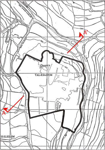
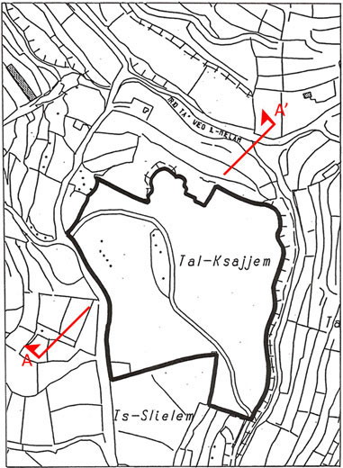
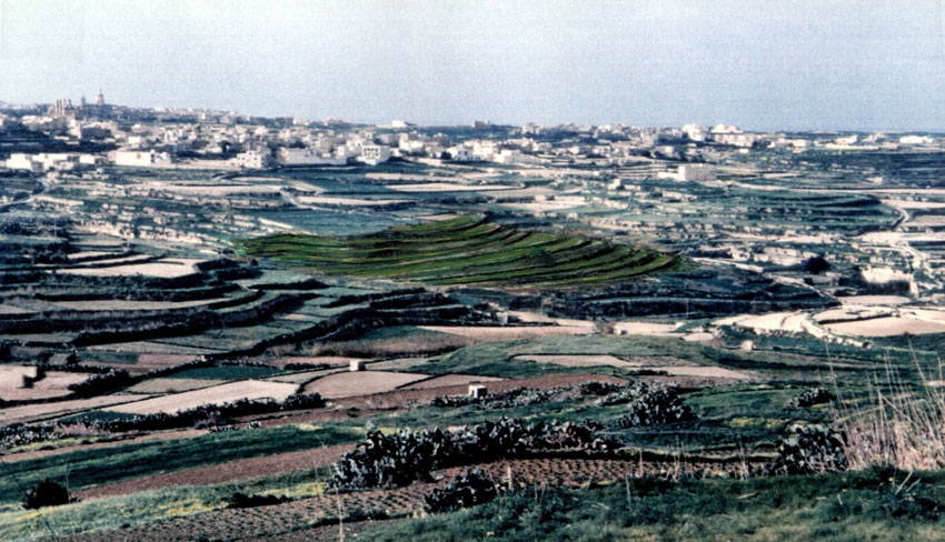
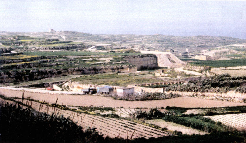
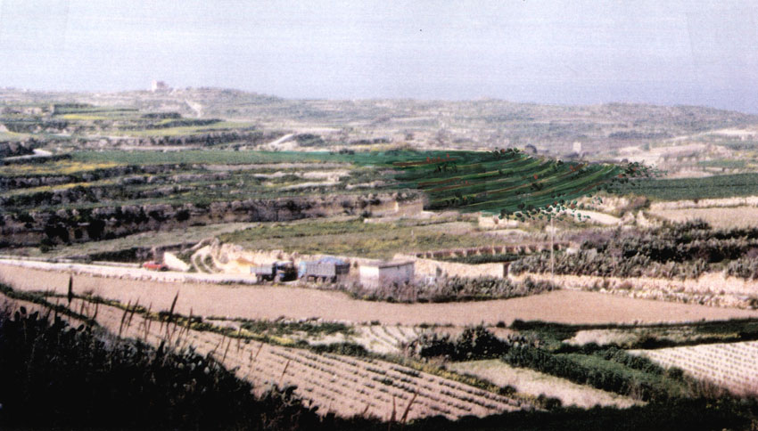
The site, a disused quarry measuring circa 2.6 hectares situated in the North Western part of the island of Gozo, is located at the side of the ecological valley of Wied il-Mielaħ, on the outskirts of the rural and picturesque village of Għarb. The rehabilitation proposal included the infilling of the quarry with inert waste and reinstating it to its former use; agriculture.
The concept of the restored site and the consequent proposed visual impacts emerged from the link between the physical components and the perceived sense of place of a particular element present in the landscape. A rehabilitation proposal perceptive of the local physical and planning conditions, based on a mathematical model, together with the integration of a number of environmental parameters was put forward.

The restoration proposal involved a designed project plan which took into consideration the long-term management of the natural and cultural assets present in the vicinity of the quarry. The suggested rehabilitation proposal was intended to enhance the site, once filled, and complement the existing landscape features. It was centred around landscape archaeology. The rehabilitation and restoration schemes were developed and their impacts assessed following geocultural, hydrological and ecological appraisals. These appraisals were incorporated in the design of the proposed schemes from the initial stages.

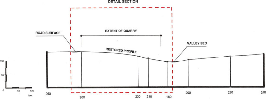
Ordnance survey sheets of 1957, 1968 and 1993 were used to identify the extent of the landscape character of the area around the quarry. The 1957 survey sheets do not distinguish between original terracing and scrapped land. Thus they are indicative of the natural topographical layout of the site, and were hence used as the conceptual planimetric layout of the proposed rehabilitation scheme. The 1968 survey sheet was used to identify contours of land and their respective position above mean sea level. Where the elements making up the landscape were present in an explicit, consistent manner, they gave character to the landscape. The main elements were identified, studied and evaluated to comprehend the inter-relationship between them and the pattern present in the landscape.

Where data was available from survey sheets with regards to contours, terracing and field boundaries, it was incorporated into the restoration proposal. Where data was not available, contours and field boundaries were designed after extrapolating present data. Since the land is sloping, fields usually follow the natural contours of the topography. Furthermore, where data was not available, field sizes were kept in the range of 0.5 to 1.0 tumolo as, given the site contours, such sizes are more effective against soil erosion.

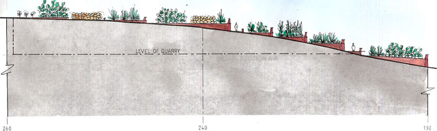
For effective protection against soil erosion, vegetation must be rapidly established. It binds soil particles together, breaks the raindrop impact, and prevents wind erosion when soil moisture content is low. The use of vines (Vitis vinifera), carob (Ceratonia siliqua), olive (Olea europea), Aleppo pine (Pinus halapensis) and sandarac gum tree (Tetraclinis articulata) as windbreakers is strongly recommended.
Given the high porosity of the restored site, excessive leaching into the underlying aquifer zone from agrarian and allied activities at the restored site should be avoided. Thus, drip-type irrigation techniques are to be exclusively used. To arrest and create a barrier against downward migration of leachates generated from surface activities, a metre thick layer of clay at 3.0 metres below level of the subsoil was proposed.
In light of the ecosystems supporting nocturnal creatures, no artificial lighting in the restoration scheme was proposed.

The proposal involved a designed project plan which takes into consideration the long term management of the natural and cultural assets that are located at Wied il-Mielaħ. The suggested rehabilitation proposal has intended to enhance the site once filled, and complement the existing landscape features.
